|
|
Booking.com | ||||||||||||||||||||||||||||||||||||||||||||||||||||||||||||||||||||||||||||||||||||||||||||||||||||||
ParzeńskoGeneral information - LocationNearest 5 places
Nearest 3 capitals
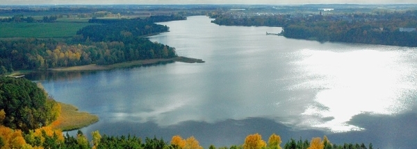
Characteristics - Physical GeographyThe Baltic Sea is the nearest seacoast with a distance of around 87 km (direction NorthNorthWest).The place is situated in the rivercatchment named Warta main - Lower - Notec, part of the larger catchment area Oder. The nearest bigger lake is Jezioro Karskie Wielkie (2.1 km2 at a height of around 17 meter above sea level) at a distance of 4.4 km in NorthNorthWestern direction).The most nearby international border is the Polish-German border with a straight distance of 46.4 km in SouthWestern direction. The estimated travel distance is around 65 km. Elevation around place: low location: 100%, The hills are mainly southwestern orientated. The most common land use in the area is forest. Name area (subregions, nature area, hills, mountains, landscape)
Nearby scheduled flights are operated from (national) airport Berlin Brandenburg Airport (at a distance of 125 km and direction WestSouthWest).The closest smaller (subnational) airport is Szczecin-Goleniów Solidarnosc Airport (at a distance of 80 km in NorthNorthWestern direction). Landscape - Landuse (within 5km)
Climate - Temperature and Precipitation |
Location of Parzeńsko in country Poland
Parzeńsko at Physical map (height map)Tourist information - Travel GuideNearest 3 UNESCO-sites
Nearest Natura2000-area
Social media - Maps
|
||||||||||||||||||||||||||||||||||||||||||||||||||||||||||||||||||||||||||||||||||||||||||||||||||||||
Relief: Altitude classes in percent (within 5km)Relief: slope classes in percent (within 5km) |
Current weather at
Weather coming 24 hours
|
||||||||||||||||||||||||||||||||||||||||||||||||||||||||||||||||||||||||||||||||||||||||||||||||||||||
5 days Weather forecast: Temperature - Pressure and PrecipitationPressure (mbar)
Wind speed (km/h)
hours
Cloud cover %
precipitation (mm)
hours
|
|||||||||||||||||||||||||||||||||||||||||||||||||||||||||||||||||||||||||||||||||||||||||||||||||||||||
|
Widget is loading comments...
|
|||||||||||||||||||||||||||||||||||||||||||||||||||||||||||||||||||||||||||||||||||||||||||||||||||||||
| number of views: 39 | |||||||||||||||||||||||||||||||||||||||||||||||||||||||||||||||||||||||||||||||||||||||||||||||||||||||


 Parzeńsko


 ©
© 


 Filming Location


