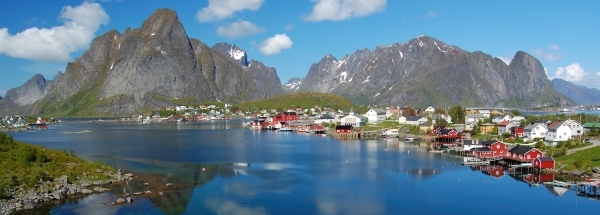
SkålevikGeneral information - Location
| Country | Norway | | Location in country |  South
South | | Location in Europe | North Europe | | Coordinates (WGS84) | Long: 8.0138,Lat: 58.0806  |
| Elevation | 3 meter above sea level | | Local time | 3:24:22am |
| At island | Flekkerøya | | Name province/region (Fylke) | Vest-Agder | | Wiki-website Subregion (Kommune) | Kristiansand |
Nearest 5 places
Nearest 3 capitals
| Capitalname |
Country |
Distance |
Direction |
| 1 Oslo | Norway | 257 km |  NorthEast
| | 2 København |  Denmark
 | 383 km |  SouthEast
| | 3 Stockholm |  Sweden
 | 599 km |  EastNorthEast
|
Characteristics - Physical GeographySkålevik lies at the Skagerrak (direction SouthSouthWest). The nearest bigger lake is Ogge (7.8 km2 at a height of around 191 meter above sea level) at a distance of 31.7 km in Northern direction).The place is located at an island named Flekkerøya. The distance to the mainland is 0.7 km.
The most nearby international border is the
Swedish-Norwegian border with a straight distance of 220.3 km in EastNorthEastern direction. The estimated travel distance is around 308 km.
Elevation around place: very low location (near sea level): 27%, low location: 73%, The hills are mainly southern orientated. The most common land use in the area is forest.
Name area (subregions, nature area, hills, mountains, landscape)
Nearby scheduled flights are operated from (national) airport Stavanger Airport, Sola (at a distance of 164 km and direction NorthWest).The closest smaller (subnational) airport is Kristiansand Airport, Kjevik (at a distance of 14 km in NorthNorthEastern direction).
Landscape - Landuse (within 5km)
| Forest |
8.6 km2 |
|
| Nature |
0.9 km2 |
|
| Agriculture |
0.6 km2 |
|
| Urban area |
6 km2 |
|
|
|
Climate - Temperature and Precipitation
|
Location of Skålevik in country Norway
Skålevik at Physical map (height map)
Tourist information - Travel Guide
Nearest 3 UNESCO-sites
Social media - Maps
|


 Skålevik


 ©
© 


 Filming Location


