|
|
Booking.com | ||||||||||||||||||||||||||||||||||||||||||||||||||||||||||||||||||||||||||||||||||||||||||||||||||||||||||||||||||||||||||||||||
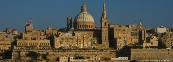
MdinaGeneral information - Location
Nearest 5 places
Nearest 3 capitals
Characteristics - Physical GeographyThe Mediterranean Sea is very close with only a distance of around 4 km (direction SouthSouthWest).The nearest mountain is Dingli Cliffs with a height of 249 meter (at a distance of 4.2 km and direction SouthSouthWest). Elevation around place: low location: 83%, hill: 17%, The hills are mainly northern orientated. The surroundings of the place have a rural character (very sparsely urbanised). The most common land use in the area is agriculture. Nearby scheduled flights are operated from (national) airport Malta International Airport (at a distance of 7.5 km and direction EastSouthEast).The closest smaller (subnational) airport is Comiso Airport (at a distance of 124 km in Northern direction). Landscape - Landuse (within 5km)
Climate - Temperature and Precipitation |
Location of Mdina in country Malta
Mdina at Physical map (height map)Tourist information - Travel GuideNearest 3 UNESCO-sites
Nearest Natura2000-area
Social media - Maps
|
||||||||||||||||||||||||||||||||||||||||||||||||||||||||||||||||||||||||||||||||||||||||||||||||||||||||||||||||||||||||||||||||
Relief: Altitude classes in percent (within 5km)Relief: slope classes in percent (within 5km) |
Current weather at Mdina
Weather coming 24 hoursMdina - MT (longitude: 14.4026, latitude: 35.8855)Distance weather station to place (direction ZZW): 0 Kilometers
|
||||||||||||||||||||||||||||||||||||||||||||||||||||||||||||||||||||||||||||||||||||||||||||||||||||||||||||||||||||||||||||||||
5 days Weather forecast: Temperature - Pressure and PrecipitationPressure (mbar)
Wind speed (km/h)
hours
Cloud cover %
precipitation (mm)
hours
|
|||||||||||||||||||||||||||||||||||||||||||||||||||||||||||||||||||||||||||||||||||||||||||||||||||||||||||||||||||||||||||||||||
|
Widget is loading comments...
|
|||||||||||||||||||||||||||||||||||||||||||||||||||||||||||||||||||||||||||||||||||||||||||||||||||||||||||||||||||||||||||||||||
| number of views: 255 | |||||||||||||||||||||||||||||||||||||||||||||||||||||||||||||||||||||||||||||||||||||||||||||||||||||||||||||||||||||||||||||||||


 Mdina
Mdina


 ©
© 


 Filming Location


