|
|
Booking.com | ||||||||||||||||||||||||||||||||||||||||||||||||||||||||||||||||||||||||||||||||||||||||||||||||||||||||||||||||||||||||||||||||||||||||||
LevaniškiaiGeneral information - Location
Nearest 5 places
Nearest 3 capitals
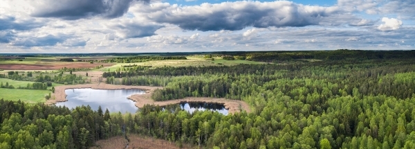
Characteristics - Physical GeographyThe Gulf of Riga is the nearest seacoast with a distance of around 217 km (direction NorthWest).The coastline is located in another country namely Latvia.The place is situated in the rivercatchment named Viliya, part of the larger catchment area Nemunas. The nearest bigger lake is ež. Dūriai (2.8 km2 at a distance of 0.2 km in SouthSouthWestern direction).The most nearby international border is the Lithuanian-Belarusian border with a straight distance of 45.9 km in SouthEastern direction. The estimated travel distance is around 64 km. Elevation around place: low location: 100%, The hills are mainly northern orientated. The most common land use in the area is agriculture. Nearby scheduled flights are operated from (national) airport Vilnius International Airport (at a distance of 71 km and direction South). Landscape - Landuse (within 5km)
Climate - Temperature and Precipitation |
Location of Levaniškiai in country Lithuania
Levaniškiai at Physical map (height map)Tourist information - Travel GuideNearest 3 UNESCO-sites
Nearest Natura2000-area
Social media - Maps
|
||||||||||||||||||||||||||||||||||||||||||||||||||||||||||||||||||||||||||||||||||||||||||||||||||||||||||||||||||||||||||||||||||||||||||
Relief: Altitude classes in percent (within 5km)Relief: slope classes in percent (within 5km) |
Current weather at
Weather coming 24 hours
|
||||||||||||||||||||||||||||||||||||||||||||||||||||||||||||||||||||||||||||||||||||||||||||||||||||||||||||||||||||||||||||||||||||||||||
5 days Weather forecast: Temperature - Pressure and PrecipitationPressure (mbar)
Wind speed (km/h)
hours
Cloud cover %
precipitation (mm)
hours
|
|||||||||||||||||||||||||||||||||||||||||||||||||||||||||||||||||||||||||||||||||||||||||||||||||||||||||||||||||||||||||||||||||||||||||||
|
Widget is loading comments...
|
|||||||||||||||||||||||||||||||||||||||||||||||||||||||||||||||||||||||||||||||||||||||||||||||||||||||||||||||||||||||||||||||||||||||||||
| number of views: 78 | |||||||||||||||||||||||||||||||||||||||||||||||||||||||||||||||||||||||||||||||||||||||||||||||||||||||||||||||||||||||||||||||||||||||||||


 Levaniškiai (Utena)


 ©
© 


 Filming Location


