|
|
Booking.com | ||||||||||||||||||||||||||||||||||||||||||||||||||||||||||||||||||||||||||||||||||||||||||||||||||||||||||||||||||||||
BeržorasGeneral information - LocationNearest 5 places
Nearest 3 capitals
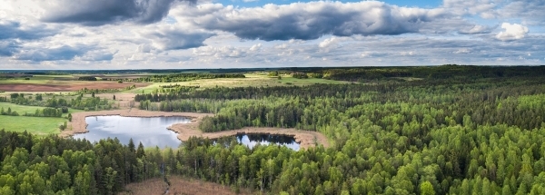
Characteristics - Physical GeographyThe Baltic Sea is the nearest seacoast with a distance of around 46 km (direction West).The place is situated in the rivercatchment named Nyoman main - Lower, part of the larger catchment area Nemunas. The nearest bigger lake is ež. Ilgis (1.3 km2 at a distance of 1.2 km in SouthEastern direction).The most nearby international border is the Latvian-Lithuanian border with a straight distance of 32.6 km in NorthNorthWestern direction. The estimated travel distance is around 46 km. Elevation around place: low location: 100%, The hills are mainly western orientated. The most common land use in the area is agriculture. Nearby scheduled flights are operated from (national) airport Riga International Airport (at a distance of 166 km and direction NorthEast).The closest smaller (subnational) airport is Palanga International Airport (at a distance of 45 km in WestSouthWestern direction). Landscape - Landuse (within 5km)
Climate - Temperature and Precipitation |
Location of Beržoras in country Lithuania
Beržoras at Physical map (height map)Tourist information - Travel GuideNearest 3 UNESCO-sites
Nearest Natura2000-area
Social media - Maps
|
||||||||||||||||||||||||||||||||||||||||||||||||||||||||||||||||||||||||||||||||||||||||||||||||||||||||||||||||||||||
Relief: Altitude classes in percent (within 5km)Relief: slope classes in percent (within 5km) |
Current weather at
Weather coming 24 hours
|
||||||||||||||||||||||||||||||||||||||||||||||||||||||||||||||||||||||||||||||||||||||||||||||||||||||||||||||||||||||
5 days Weather forecast: Temperature - Pressure and PrecipitationPressure (mbar)
Wind speed (km/h)
hours
Cloud cover %
precipitation (mm)
hours
|
|||||||||||||||||||||||||||||||||||||||||||||||||||||||||||||||||||||||||||||||||||||||||||||||||||||||||||||||||||||||
|
Widget is loading comments...
|
|||||||||||||||||||||||||||||||||||||||||||||||||||||||||||||||||||||||||||||||||||||||||||||||||||||||||||||||||||||||
| number of views: 75 | |||||||||||||||||||||||||||||||||||||||||||||||||||||||||||||||||||||||||||||||||||||||||||||||||||||||||||||||||||||||


 Beržoras


 ©
© 


 Filming Location


