|
|
Booking.com | ||||||||||||||||||||||||||||||||||||||||||||||||||||||||||||||||||||||||||||||||||||||||||||||||||||||||||||||||||||||||
RaudaskyläGeneral information - LocationNearest 5 places
Nearest 3 capitals
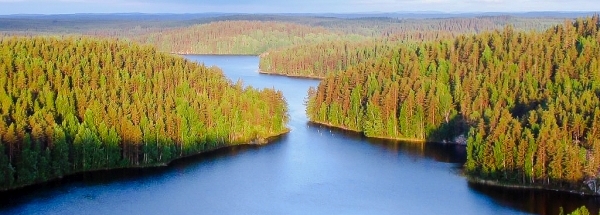
Characteristics - Physical GeographyThe Gulf of Bothnia is the nearest seacoast with a distance of around 52 km (direction WestNorthWest).The place is situated in the rivercatchment named Oulujoki coastal: Kala, Pyha, Siika, part of the larger catchment area Oulujoki-Iijoki. The nearest bigger lake is Pidisjärvi (3.8 km2 at a height of around 68 meter above sea level) at a distance of 13.2 km in SouthEastern direction).The most nearby international border is the Swedish-Finnish border with a straight distance of 190.8 km in NorthNorthWestern direction. The estimated travel distance is around 267 km. Elevation around place: low location: 100%, The hills are mainly flatern orientated. The most common land use in the area is forest. Name area (subregions, nature area, hills, mountains, landscape)
Nearby scheduled flights are operated from (national) airport Helsinki Vantaa Airport (at a distance of 411 km and direction SouthSouthEast). Landscape - Landuse (within 5km)
Climate - Temperature and Precipitation |
Location of Raudaskylä in country Finland
Raudaskylä at Physical map (height map)Tourist information - Travel GuideNearest 3 UNESCO-sites
Nearest Natura2000-area
Social media - Maps
|
||||||||||||||||||||||||||||||||||||||||||||||||||||||||||||||||||||||||||||||||||||||||||||||||||||||||||||||||||||||||
Relief: Altitude classes in percent (within 5km)Relief: slope classes in percent (within 5km) |
Current weather at
Weather coming 24 hours
|
||||||||||||||||||||||||||||||||||||||||||||||||||||||||||||||||||||||||||||||||||||||||||||||||||||||||||||||||||||||||
5 days Weather forecast: Temperature - Pressure and PrecipitationPressure (mbar)
Wind speed (km/h)
hours
Cloud cover %
precipitation (mm)
hours
|
|||||||||||||||||||||||||||||||||||||||||||||||||||||||||||||||||||||||||||||||||||||||||||||||||||||||||||||||||||||||||
|
Widget is loading comments...
|
|||||||||||||||||||||||||||||||||||||||||||||||||||||||||||||||||||||||||||||||||||||||||||||||||||||||||||||||||||||||||
| number of views: 118 | |||||||||||||||||||||||||||||||||||||||||||||||||||||||||||||||||||||||||||||||||||||||||||||||||||||||||||||||||||||||||


 Raudaskylä


 ©
© 


 Filming Location


