|
|
Booking.com | ||||||||||||||||||||||||||||||||||||||||||||||||||||||||||||||||||||||||||||||||||||||||||||||||||||||||||||||||||||||||||||||
VejringeGeneral information - Location
Nearest 5 places
Nearest 3 capitals
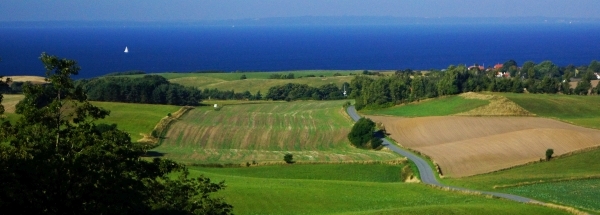
Characteristics - Physical GeographyThe Baltic Sea is very close with only a distance of around 3 km (direction EastNorthEast).The place is situated in the rivercatchment named Zealand. The nearest bigger lake is Hejrede Sø (0.5 km2 at a distance of 34.3 km in WestSouthWestern direction).The place is located at an island named Falster. The distance to the mainland is 34.8 km.The nearest mountain is UNK with a height of 21 meter (at a distance of 3.3 km and direction SouthEast). The most nearby international border is the Danish-German border with a straight distance of 171.3 km in Western direction. The estimated travel distance is around 240 km. Elevation around place: very low location (near sea level): 66%, low location: 34%, The hills are mainly northeastern orientated. The most common land use in the area is agriculture. Nearby scheduled flights are operated from (national) airport Copenhagen Kastrup Airport (at a distance of 91 km and direction NorthNorthEast). Landscape - Landuse (within 5km)
Climate - Temperature and Precipitation |
Location of Vejringe in country Denmark
Vejringe at Physical map (height map)Tourist information - Travel GuideNearest 3 UNESCO-sites
Nearest Natura2000-area
Social media - Maps
|
||||||||||||||||||||||||||||||||||||||||||||||||||||||||||||||||||||||||||||||||||||||||||||||||||||||||||||||||||||||||||||||
Relief: Altitude classes in percent (within 5km)Relief: slope classes in percent (within 5km) |
Current weather at
Weather coming 24 hours
|
||||||||||||||||||||||||||||||||||||||||||||||||||||||||||||||||||||||||||||||||||||||||||||||||||||||||||||||||||||||||||||||
5 days Weather forecast: Temperature - Pressure and PrecipitationPressure (mbar)
Wind speed (km/h)
hours
Cloud cover %
precipitation (mm)
hours
|
|||||||||||||||||||||||||||||||||||||||||||||||||||||||||||||||||||||||||||||||||||||||||||||||||||||||||||||||||||||||||||||||
|
Widget is loading comments...
|
|||||||||||||||||||||||||||||||||||||||||||||||||||||||||||||||||||||||||||||||||||||||||||||||||||||||||||||||||||||||||||||||
| number of views: 135 | |||||||||||||||||||||||||||||||||||||||||||||||||||||||||||||||||||||||||||||||||||||||||||||||||||||||||||||||||||||||||||||||


 Vejringe


 ©
© 


 Filming Location


